© Rob Wood

© Rob Wood

© Met Office

© Rob Wood


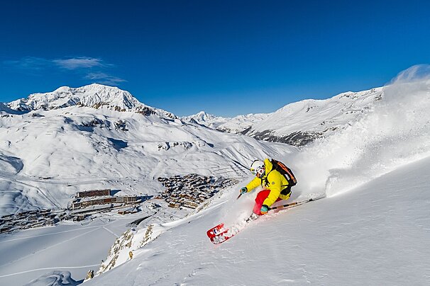
Snow and sunshine in the Alps this week
Take a look at our 7-day forecast
The recent pattern of varied weather looks set to continue this week with a mixture of fresh snow, some sunshine and moderate winds again but, thankfully, not as strong as we have seen this week.
The all-important Jetstream looks set to remain in its current position across central France for the main. However, it will move to the north on Tuesday and Wednesday when we look set to have a lovely couple of sunny days with light winds.
Monday
A warm-weather front approaching from the Atlantic will bring with it some precipitation. This will fall as snow on the higher slopes but, with increasing temperatures and a rising freeze point (up to around 2200 metres), this may fall as rain at lower elevations. Winds will be at their strongest in the morning at around 30km/h from the north-west and will drop as the day goes on, as the wind backs round to the west. Overnight winds will veer to the north and drop to around 15km/h by Tuesday morning.
Tuesday
A lovely sunny day with only a light breeze (around 10km/h) with temperatures of around 2ºC at 2000 metres.
Wednesday
Without a doubt, the best day of the week with very light southerly winds (5km/h), sunshine and only a few clouds, it will be lovely! Temperatures look set to rise to around 3ºC at 2000 metres – a real day for a lunch up on the hill in the sunshine. High pressure at around 1028Mb but an approaching cold weather front again means more unsettled weather towards the end of the week, as pressure drops behind the front to around 1012Mb.
Thursday
The day will begin with some sunshine but clouds will build up as the day goes on. Winds will increase to around 20km/h from the south. With the cloud will come some fresh snow, with around 15cm in the forecast late in the day and into Friday. A freeze height of around 1500 metres should ensure that it falls as snow at all but the very lowest of elevations (less than 1400 metres).
Friday
Heavy cloud cover will bring snowfall at all elevations with a freeze height of around 1200 metres. The snowfall will be at its heaviest overnight on Thursday and into Friday morning and eases as the day goes on. Around 30cm is likely to fall on Friday.
Saturday
The snowfall should finish overnight on Friday and Saturday will start with light winds at around 5km/h from the north with a mixture of sunshine and light cloud. Temperatures at around 0ºC at 2000 metres in the afternoon.
Sunday
Again, light winds at around 5km/h from the east backing to northerly as the day goes on. Warmer temperatures at around 4ºC at 2000 metres in the afternoon. Mainly sunny with some light high altitude cloud, it should be a nice day on the slopes.

![a picture of a hotel suite at [itemref]](https://cdm0lfbn.cloudimg.io/v7/_images_base_/image_uploader/photos_e2/original/campanules-174-suite.jpg?ua=1579868018&p=carousel)